The new version also includes historical imagery, so you can go back in time using the time slider bar to see how different areas have changed. Google has also added a tour capture tool that lets you record your navigation through Google Earth in real-time that you can then save and play back or share with friends. And as if exploring the Earth's terrain, and now the ocean terrain, wasn't enough, they've also included Mars mode, which lets you explore Mars in 3D as well.
Check out this short video highlighting most of the new features:
While these are all great additions, there's even more great features that will definitely appeal to the geocachers out there.
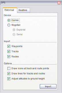
 In version 5.0, you can now easily load your GPS waypoint, track and route data right from your GPS receiver. Google Earth supports over 200 different GPS models. Just connect your device to your computer, turn it on, and in G.E., open the GPS dialog box (see left) under the tools menu and watch as your data loads right into the application.
And, if you want to follow yourself in realtime on Google Earth, just connect your GPS unit to your laptop, click on the "realtime" tab (see left), and start tracking your movements.
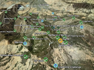
Another nice feature is the added ability to load GPX data into Google Earth simply by dragging and dropping the files right on the Google Earth screen. This is a great way to visualize your pocket queries to see cache sites that you plan to visit, or caches you've already found. It's as easy as 1, 2, 3:
1. Extract the GPX file from your pocket query download:

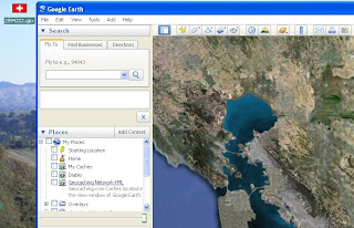
2. Drag and drop the GPX file onto Google Earth:

3. Choose your options:

You can even use the time slider bar to watch as caches appear according to the date they were placed.
Similarly, if you have GPX track data that you've saved from previous excursions, Google Earth will read and display those files too. And, if the data contains time stamps, you can use the time-slider bar to follow the progression of your tracks. There's a nice discussion of this feature in this Google Lat-Long Blog Post.
I've always been a big fan of Google Earth as a viewer of GPS track and geocaching waypoint data. And I am thrilled at how easy it is to do this now in version 5.0. So, if you've never tried loading your GPS and geocaching data into Google Earth before, now is definitely the time to give it a whirl.
Happy Caching!

2 comments:
can't wait for the location feature to be released, haz iPhone will geocache!
This is good. Can I get rid of the web label?
Post a Comment